
 |
| Instructions for downloading and using Google Earth |
What is Google Earth?
The app was originally called Keyhole EarthViewer, but was later acquired by Google in October 2004 and has since been renamed Google Earth. This is a computer program that displays a 3D map of the Earth thanks to satellites placed in space and GIS data on a 3D globe, allowing users to view cities and landscapes from many angles. different degrees.

Instructions to download Google Earth to your computer
In today’s article, I will show you how to use Google Earth on a Web browser because the interface is easier to use. If you want to download it for use on your computer , please follow the steps below!
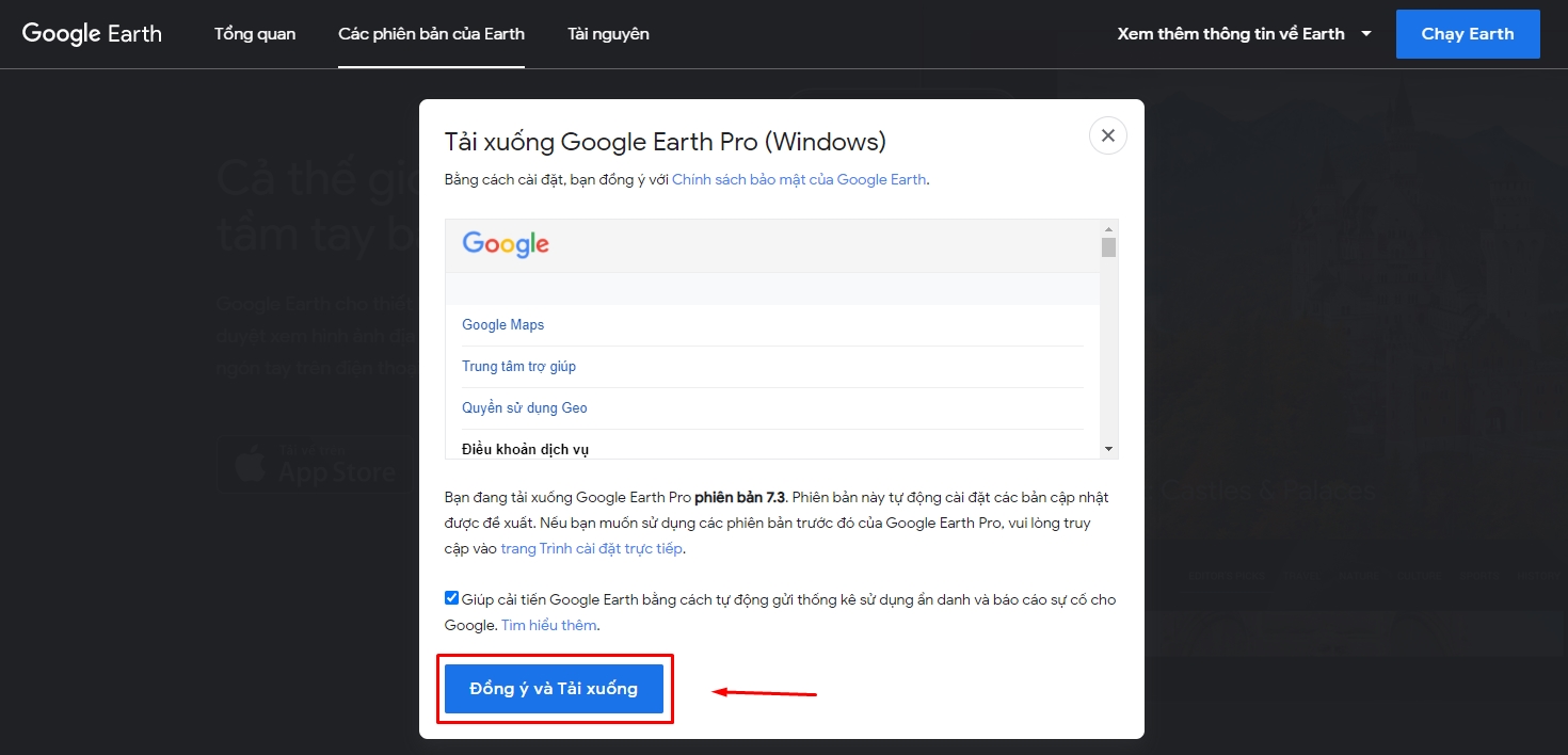
Step 1: Visit the website to download Google Earth Pro here > Click Agree and Download .
Step 2: Open the downloaded file application > Click Run .
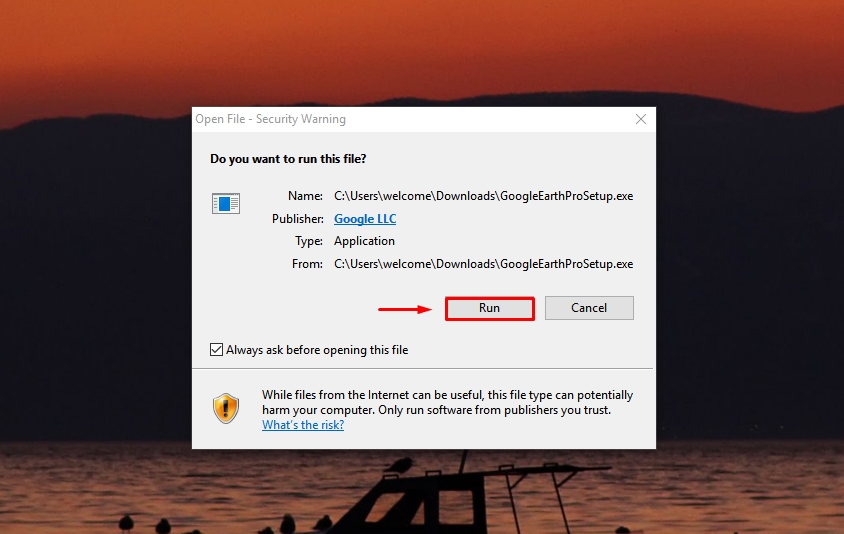
Then wait for the system to automatically download and install > When the installation is complete, click Close .

Then wait for the system to automatically download and install > When the installation is complete, click Close .

Instructions on how to use Google Earth
Step 1: Visit Google Earth on the web to view the 3D map by following the link here.
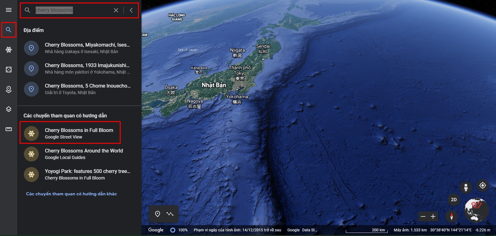
Step 2: Click on the magnifying glass icon and enter the location you want as shown below. For example, let’s go to see cherry blossoms in Japan.
Enter the keyword “cherry blossoms” > Then select Cherry Blossoms in full bloom.
Step 3: Then, the program will take you to Japan and pin the places where cherry blossoms bloom on the map of Japan. On the right hand side will be a list of places to see cherry blossoms > Click to select a place you want in the list.

Step 4: You will be redirected to that location and are in street view (human icon) to see the surroundings.
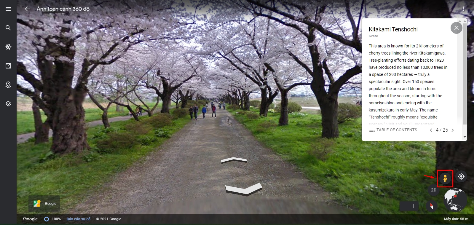
In street view, you can move forward, backward, left, and right according to the navigation arrows on the map for a more intuitive view.
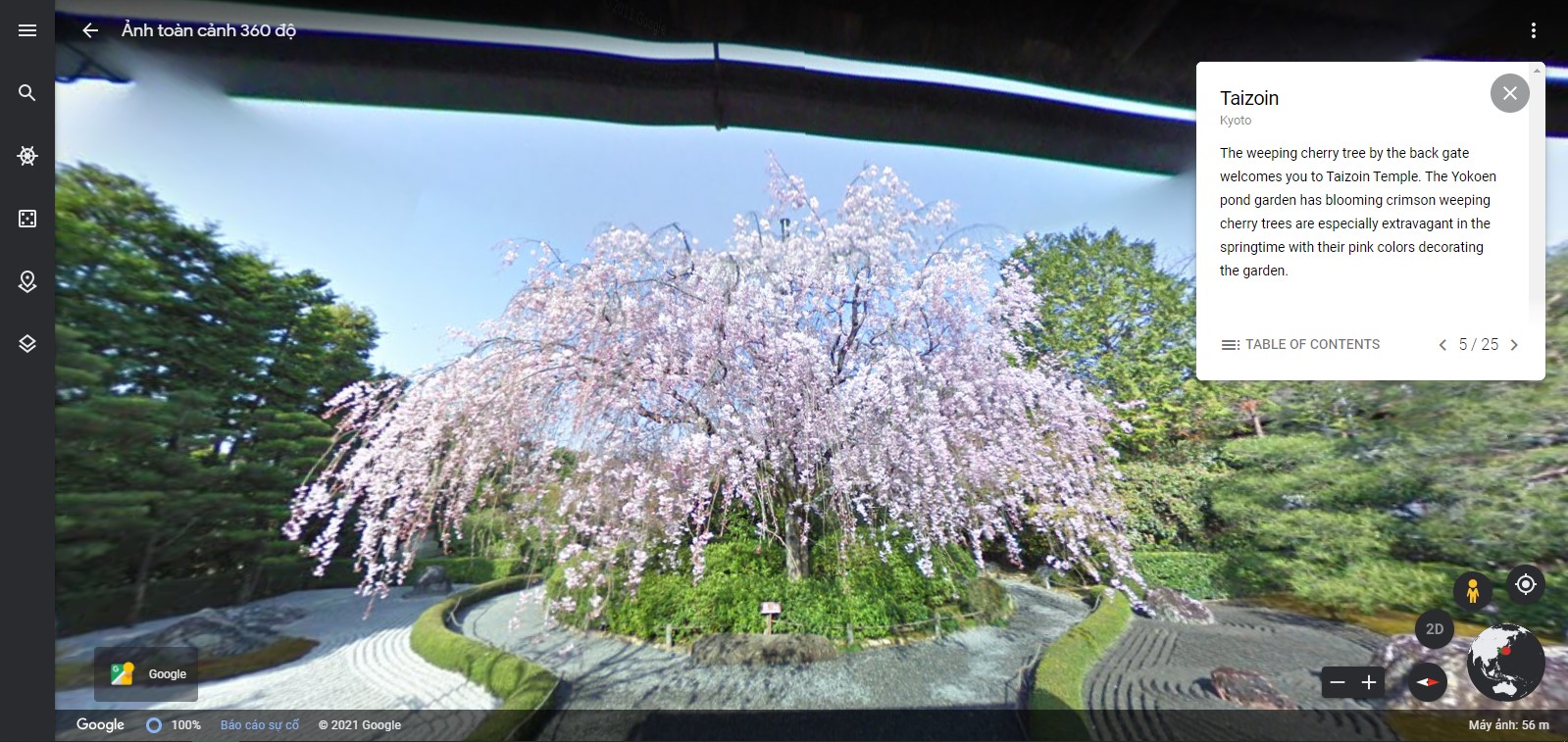
And on the right-hand side, you will see a table of contents so you can choose and navigate to the place you want.
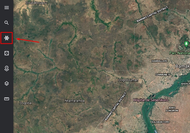
Step 5: Also, to view the map in 3D or 2D, the first thing is to exit street view by pressing the human icon again. Then the map will automatically switch to 2D mode as shown below.

To change the tilt angle to 3D, click as shown below.

In addition, you can also perform navigation with the following command:
- Click and drag to move the map.
- Use the mouse wheel to zoom in and out of the map.
- Hold down Shift, then click and drag to change the degree of tilt or rotate the view.
- Hold down Ctrl and click and drag to change the viewing angle.

Then you have the option items such as Nature, Games, Culture, Tourism, Education … or suggested locations from Google Earth to explore.


Done, click Slideshow, and the map will automatically display the locations you have added to the project.

Step 8: You can also change the type of map displayed as you like, such as hiding/showing all information or customizing only the information you want to display.
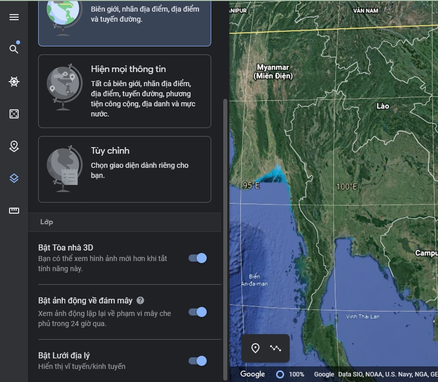
At the same time, you can also turn on the geogrid for the map to see the longitude/latitude…

Step 9: Measure the distance on Google Earth by clicking on the ruler icon and dot on the points you want to measure as shown below. And the measured distance results will be displayed in the right-hand panel.

Epilogue
Above is an article that shows you how to use Google Earth to explore places in the world. I find this program very useful for those of you studying geography and those who like to travel, you can preview the place you want.


